|
Christian's Transcontinental Drive |
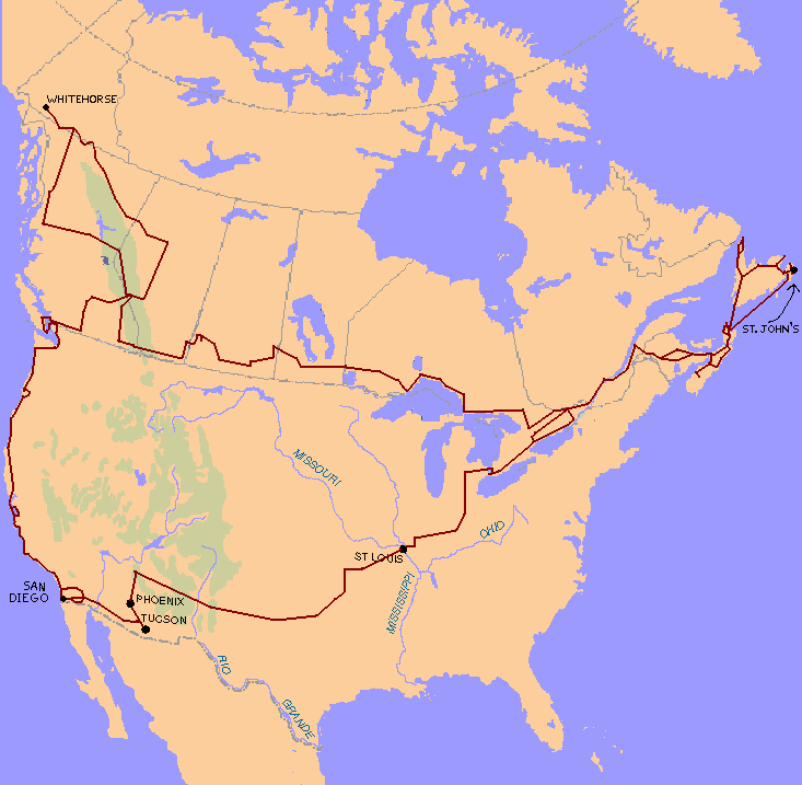
In the summer of 1998, I packed most of my belongings into a storage locker, crammed the rest into my faithful Mazda 323, and hit the road. In the course of a few months, I visited St. John's (Newfoundland), Whitehorse (Yukon Territory), and San Diego (California), along with a few points in-between. This is the story of some of the places I went, some of the people I met, and a few of the things I saw.
| Tuesday, June 30 |
Toronto, ON: 195 109 kms
|
| Thursday, July 2 |
Ottawa, ON: 195 578 kms
|
| Friday, July 3 |
St. Basile, NB: 196 349 kms
|
| Saturday, July 4 |
Wolfville, NS: 196 424 kms
|
| Friday, July 31 |
Wolfville, NS: 198 177 kms
|
I spent most of the day wrapping things up in Wolfville, bade farewell to Acadia University (it's funny to think that another month/year has gone by), and headed to Halifax along NS-101. It's a pretty drive as far as St. Croix (especially the mud flats at Windsor--a somewhat unexpected by-product of the causeway that was built there a couple of decades ago), but it then heads inland across the province and is pretty dull--lots of coniferous trees in a rocky landscape.
Drew Campbell (a fellow Shad Acadia '91 alumnus) was kind enough to put me up for the night. We headed out to the Granite Brewery for dinner (the "peculiar" was excellent, and the food wasn't bad either--highly recommended!), and chatted about life and the ways of the world. I'm afraid I wasn't terrific company because I had had roughly 3 hours sleep the night before. :(
| Saturday August 1 |
Halifax, NS: 198 269 kms
|
Had breakfast with Drew at Smitty's, then headed east, across the
MacDonald bridge (nice view) and out NS-7, NS-107, and NS-7.
The ``Marine Drive'' (coast-hugging road from Halifax to the Canso
Causeway) consists mainy of rocky coast crammed with conifers.
It's a pleasant, relaxing and scenic drive, but it isn't in the
same league as the ``Evangeline'' or ``Glooscap'' scenic trails.
Stopped for lunch at an awesome restaurant just past the end of
the "new" expressway (NS-107)... I only wish that I could remember
the name!
Followed NS-7 until it turns inland for Antigonish; then I turned off onto NS-211. There's a ferry on NS-211 between Port Bickerton and Isaac's Harbour, which my MapArt map did not indicate (the AAA map shows it correctly); it took roughly 30 minutes and cost $1.75, so I'm not about to complain. At Isaac's Harbour, I followed NS-316 east along the coast. Just outside of Tor Bay, I met a deer; fortunately, I saw it standing by the side of the road watching me, and applied the brakes forcefully; just as I was drawing level with it, it decided to stop standing there and ran across the road right in front of me. Go figure.
Because it was starting to get dark, I decided to make up some time by cutting inland at Larry's River... it turned out to be a nice paved road until Lundy, at which point it became a gravel road--nonetheless, it was wide and in good condition. Stopped for the night at Boylston Provincial Park; there's a spectacular view from the registration area overlooking Chedabucto Bay.
| Sunday August 2 |
Boyleston, NS: 198 631 kms
|
Left Boylston, and followed NS-344 east through Mulgrave (which is worth a side-trip off the Trans-Canada Highway if you're in the neighbourhood--a nice place to look at) to the Canso Causeway and onto Cape Breton Island. Followed NS-105 (the TCH) north to Nyanza, and turned off onto the Cabot Trail.
I suspect that most ``dumb tourists'' think Cape Breton is almost entirely Scottish; I for one hadn't realized how francophone the north-west coast is. From Belle Cote through Cheticamp, it was clear that I was in French-Canadian territory. It's also a gorgeous drive: the highway winds along close to the water's edge, with low, rolling hills to the east. There was a traffic jam (!) in Cheticamp, because of a parade that afternoon.
After Petit Etang, the Cabot Trail enters Cape Breton Highlands National Park. My nominee for ``most beautiful spot'' on the trail is just past the park entrance, at Cap Rouge. A close second is ``Cabot's Landing'' Provincial Park, just off the trail by Cape North.
(Giovanni Caboto, a.k.a. John Cabot, ``discovered'' North America in 1497, five years after Columbus, and returned to England with tales of a land of plenty, where fish were so thick in the water that they could be harvested with baskets. The English returned, claimed Newfoundland and, later, the mainland as well, and proceeded to fish the cod to the brink of extinction. The actual site of Cabot's landfall is unclear, but many jurisdictions are eager to portray themselves as the site in a quest for glory and tourist dollars.)
In a fit of exploration, I made it up past ``Cabot's Landing,''
through Capstick, to Meat Cove. (If I was going to drive to the
north end of Cape Breton, I might as well do it right.
| Monday August 3 |
Skir Dhu, NS: 199 062 kms
|
Carried on through St. Ann's to the TCH, and stopped for breakfast at the TCH/Cabot Trail juction, where they had a spectacular view of St. Ann's Bay and made the best Capuccino I've found east of Montreal. Then drove over Kelley's Mountain to North Sydney. It's the scariest bit of the TCH east of Calgary: NS-105, a highway with a speed limit of 100 km/h, suddenly curves twice while in the midst of a steep downgrade. The first curve is rated at 80 km/h, the second at 40 (!), and I suspect that overturned tractor-trailers are a semi-regular event.
Because I was early for the ferry, I made a detour along NS-125 into Sydney, where it was the Civic Holiday, and the city was in the midst of a busker festival. Then followed NS-125, NS-223 and NS-305 into North Sydney and added myself to the queue waiting to board the ferry to Argentia NF.
Marine Atlantic Ferry Lines (a federal-government corporation providing subsidized ferry service as an extension of the TCH) was celebrating the 100th year of regular ferry service between North Sydney NS and Port-aux-Basques NF. They had an attractive display in the terminal building showing pictures of various ferries that had been used over the years. Most of these captions told a story similar to this: ``The [name of ship] entered service on [date] and provided many years of faithful service. It was beloved by scores of passengers. Unfortunately, it was lost at sea on [date].'' And then there was the large display of newspaper clippings about the SS Caribou, which was torpedoed by a NAZI U-Boat in 1942 while travelling the Port-aux-Basques - North Sydney run. There was also a picture of one of the two passenger ferries currently in service (the MV Caribou, so named in memory of the torpedoed ship) in a heavy sea: it looked like a toy boat in a child's bathtub, with a wave about to break over the bow. It struck me that this was, perhaps, not the most appropriate disply to show people who were about to board a ferry!
The ferry (MV Joseph & Clara Smallwood, sister ship to the MV Caribou) seemed huge: with space for 350 cars on two decks (the terminals in North Sydney and Port-aux-Basques have special double-deck loading ramps to move cars onto and off the ships more quickly), it had 4 decks for passengers to stroll around on, including a cafeteria, a snack bar, a gift shop, a night club, a lounge which doubled as a movie theatre, a mini-golf course and, of course, lots of sleeping accomodation. I was shocked that it took the better part of an hour just to load, but it departed on schedule.
| Tuesday August 4 |
Argentia, NF: 199 210 kms
|
Coming on deck as the ship was pulling into Argentia NF, I was absolutely awe-struck by the sight of the rocky coastline of round hills. When the tourist brochures speak of a stupendous, primordial landscape, they're not exaggerating.Argentia itself is tiny, and the marine terminal lacks a double-deck loading ramp, so unloading the cars was a slower process. In fact, the huge ferry looked very out-of-place in that small bay. The two-lane highway (NF-100) toward the TCH also developed a congestion problem as the long line of cars made its way toward the rest of Newfoundland.
Following NF-100 to NF-1 (which, as a sign proudly proclaims, is the Trans-Canada Highway), I headed west to Shoal Harbour. The TCH in Newfoundland is, in my opinion, the best part of the entire Trans-Canada Highway system from a recreational-driving perspective. It's almost entirely new pavement, with two wide lanes, a third (passing) lane whenever there's an uphill climb, and wide, paved shoulders, also in pristine condition. The speed limit is 100 km/h, and you can drive it, although it's almost 50% up-hill climbs that my Mazda 323 had a little trouble going up at that speed. ;-)
From Shoal Harbour, I turned east on NF-230. In Port Union, I stopped and tried to buy some 35mm film for my camera. The store clerk and I had a lot of trouble understanding each other; both of us are native English speakers, but (being from Ontario) my accent was strange and hard-to-understand. Likewise, I needed several repetitions before I could make out what she was saying. This was to become a familiar pattern during my sojourn on the ``Rock''. I've had less trouble making myself understood in Quebec or German-speaking Switzerland, both of which are notorious for distinctive local accents.
From Port Union, I continued on NF-230 to NF-238 to Bonavista. Why did I go there? I suppose that it had a lot to do with the song that, as a child growing up in Canada, got driven into my head:
|
This land is your land, this land is my land,
From Bonavista to Vancouver Island, From the Arctic Circle, to the Great Lakes' waters, This land was made for you and me. |
I didn't realize until I got there that Bonavista also purports to be the site of Cabot's landfall (complete with statue and a plaque that was worded almost identically to the one I'd read in NS on Sunday--I experienced a sense of deja vu). There's also an interesting old lighthouse (with a nifty hand- and gravity-powered mechanism to spin kerosene lanterns in the tower that was in use until 1967 (!)), and a scenic lookout point where I saw a huge flock of puffins. (Mental note: next time, bring binoculars!).
The Matthew, a best-guess reconstruction of Cabot's ship, was also in Bonavista for the summer. The government has spent hundreds of thousands of dollars building the ship (which is not and will not be allowed to sail the waters around NF because it has no on-board engine and, hence, does not meet marine vessel safety requirements!), but now can't find the cash to build a hangar to put the vessel in for the winter. I hope they come up with something.
Leaving Bonavista, I headed back inland along NF-235 and NF-230, then took the TCH east, and camped for the night at Gushue's Pond Provincial Park.
| Wednesday August 5 |
Avondale, NF: 199 758 kms
|
Taking the TCH the rest of the way east into St. John's, I started off the day with a silly ``dumb tourist'' blunder. You see, it was time to get my car's oil changed, so I pulled into the Mazda dealership on Kenmount Rd. (what the TCH turns into as it enters the city), and went looking for a service person. The lot was deserted, the dealership's doors were locked, but there was no sign in the window to indicate any abnormal situation. I was puzzled, because it was a weekday, and after the establishment's posted opening time.
Proceeding further into St. John's, I did my best to stay on the TCH. I figured that, since I was at the eastern extremity of the Trans-Canada Highway, I might as well try to drive it to the terminus. This proved more difficult than I had anticipated; as the road enters St. John's, it forks repeatedly, and it is often anything but clear which direction might be considered "straight." In fact, with the proliferation of 3-way and 5-way intersections, often on steep hills, it became increasingly difficult to determine a safe direction in which to proceed, much less a straight one. St. John's traces its history back into the 16th century (it predates Quebec City!), and its clear that the original town planning did not envision the large volume of motor vehicle traffic that is present today. I found myself becoming increasingly terrified as I made my way toward the harbour--the final straw came when I reached the intersection of Carter's Hill and Livingstone St. Being on Carter's Hill, I had a stop sign; the traffic crossing in front of me, on Livingstone St., had a traffic light; and, from where I was waiting for an opportunity to proceed, I couldn't see whether their traffic light was red or green! I freaked out, parked the car in the next block, and spent the rest of the day on foot.
I soon discovered the reason why the city was shut down and the downtown core deserted: it was Regatta Wednesday. While the rest of Newfoundland (and, indeed, most of the rest of Canada) takes the first Monday in August off as a holiday, the city of St. John's, instead, takes a holiday on the first Wednesday in August, when the Royal St. John's regatta is run. This was the 172nd (?) annual regatta (the institution predates Canada!), and the majority of the city spent the day on the shores of Quidi Vidi Lake, which had been turned into an immense Midway, with food concessions, gaming booths, and rides. A few of them were even watching the races. ;)
On my way over to watch the Regatta, I stopped in at the Tourist Information railcar on the waterfront, and had a chat with the friendly woman behind the counter, inquiring as to what there was to see and do in St. John's on a Regatta Wednesday. She recommended the obvious: go see the Regatta, and added that the Signal Hill monument was open and worth a visit. She then started to recommend the hiking trail from Signal Hill to Quidi Vidi lake, but thought better of it: "It's too hot today--you'll melt if you try that." I did my best to keep a straight face as I explained that, being a Southern Ontarian, I had previous experience walking on days like this one--it was 20 degrees Celsius in the sun. ;)
On the top of Signal Hill, there's an equidistant-projection map of the world, centered around St. John's. It was a bit of an eye-opener to me to realize that, from that point, London England is signifigantly closer than Vancouver, and Moscow is closer than Whitehorse. Canada may have a small population, but we have one incredibly huge amount of land.
That evening, I hooked up with Alan Layte, my roomate from Shad Acadia, who's finishing up his engineering degree at the Memorial University of Newfoundland (MUN). Together, we made the trip out to Cape Spear (the easternmost point of the island of Newfoundland and, hence, the "Far East of the Western World"), where I got my first (and only) taste of Newfoundland's legendary pea-soup fog; my perception of the ambient temperature dropped from 20C to 5C, and visibility plunged to a few yards. Strangely, this phenomenon was limited to the Cape; when we drove back to St. John's, it was still a sunny day, with nary a cloud in the sky.
Alan also gave me a tour of MUN, took me back up Signal Hill for a night-time view of the city, and graciously put me up for the night.
| Thursday August 6 |
St. John's, NF: 199 816 kms
|
Had breakfast with Alan at the Irving Big Stop on the outskirts of St. John's, and then headed off to the Mazda dealer to get the oil changed. There, I had a bit of a surprise. It seems that (at least on Mazda 323s), the constant-velocity joint that is part of the front-wheel drive mechanism is encased in a rubber-like plastic ``boot'' which contains some lubricant. Eventually, the plastic cracks, the lubricant runs out onto the ground, and the recommended practice is to replace half the axle (!).
Because it was going to take them 24 hours to get the part shipped in, I spent a chunk of the day going back to Cape Spear, where it was warm and sunny (go figure) writing some post-cards. I then went for a scenic drive along the Avalon Peninsula (around and about greater St. John's, and then south on NF-10), and ended up spending the night at La Manche provincial park.
| Friday August 7 |
La Manche, NF: 199 984 kms
|
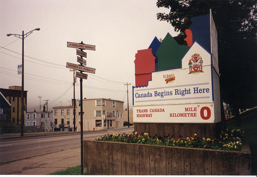
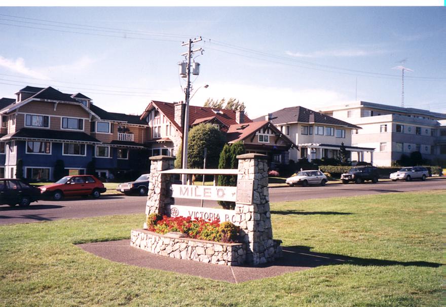
Heading back into St. John's, the odometer on my car flipped past 200 000 kms. Passing by the Tourism Department, I stopped to snap a picture of the "Mile 0" marker for the Trans-Canada Highway. I got kind of excited when I saw the arrow pointing to "Victoria B.C. 7775km -->". It was only 3200 kms to Ireland.
I visited the Mazda dealer and, an hour and a few hundred dollars later, placed myself squarely on the westbound TCH. "Go west, young man!" I thought to myself with a grin.
Once I reached the outskirts of St. John's, the TCH was a four-lane, controlled-access expressway, with entirely new asphalt paving. That lasted for about 80 kms, at which point the highway became two-lane, and the access points, although limited, no longer had overpasses. For the first hundred kms or so, road-side vendors were a frequent sight, all advertising "bake apples." Having spotted some of those on the way in from the ferry on Wednesday, I'd mistaken the signs for "baked apples"--but, as Alan set me straight, they're actually a gold-coloured fruit very much like raspberries. I contemplated stopping at a few of the vendors but, by the time I'd seen them, it was invariably too late (in my somewhat timid estimation) to safely decelerate and pull over--perhaps I'm just not used to the concept of road-side pull-outs where the speed limit is 100 km/h.
Following the TCH for the next few hours, I was continually impressed by the scenery. The road is very hilly (eastern Canadians might even call it mountainous, although British Columbians would scoff at such a notion). For the first time in the 78 000 kms that I'd been driving my Mazda, it actually had trouble maintaining the speed limit; while it would do 90 over even the steepest of those hills, the posted 100 km/h was occasionally a little beyond its grasp. The highway was almost devoid of traffic (the 401 through Toronto never gets that empty, not even at 4am), and all of the major upgrades had substantial passing lanes, so being velocitally-challenged was not a problem.
Passing through Terra Nova National Park (the fourth one I'd made it to that summer), the speed limit dipped to 90 km/h, and there were several signs posting dire warnings about moose on the roads. I'd been warned in uncertain terms about this, and had, in fact, noticed that several tractor-trailer rigs in the province have a grill of substantial metal bars welded to the front to absorb impacts. Thankfully, no moose were encountered.
About two in the afternoon, I made it to Gander.
| Saturday August 8 |
South Brook, NF: 200570 kms
|
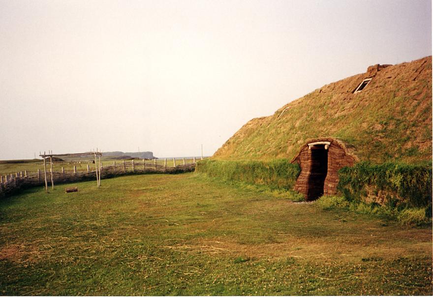
A Norse boat at L'Anse-aux-Meadows
A Norse hut at L'Anse-aux-Meadows
| Sunday August 9 |
Raleigh, NF: 201 188 kms
|
| Monday August 10 |
North Sydney, NS: 201 986 kms
|
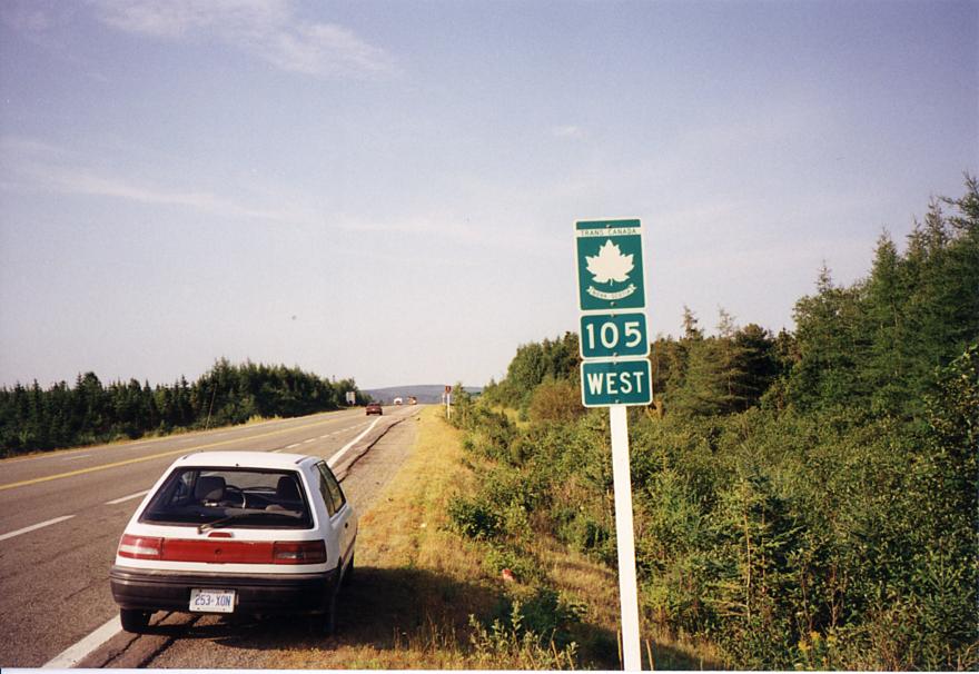
The Trans-Canada Highway through Nova Scotia
| Tuesday August 11 |
Moncton, NB: 202 483 kms
|
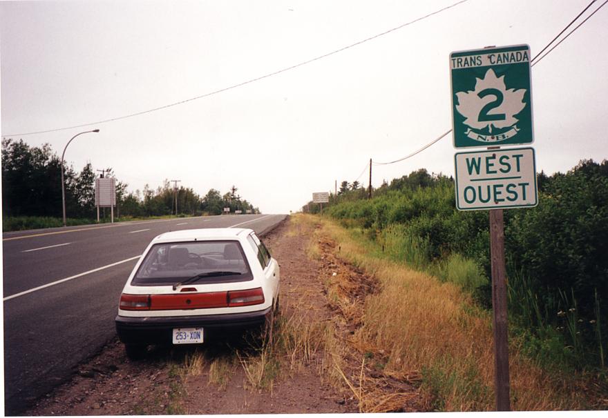
The Trans-Canada Highway through New Brunswick
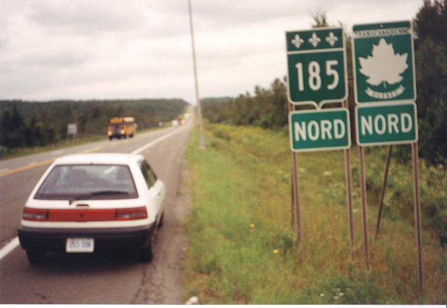
The Trans-Canada Highway through Qu�bec
| Wednesday August 12 |
Ottawa, ON: 203 940 kms
|
| Tuesday August 18 |
Dwight, ON: 204 466 kms
|
| Wednesday August 19 |
Lake Superior Provincial Park, ON: 205 286 kms
|
| Thursday August 20 |
Thunder Bay, ON: 205 929 kms
|
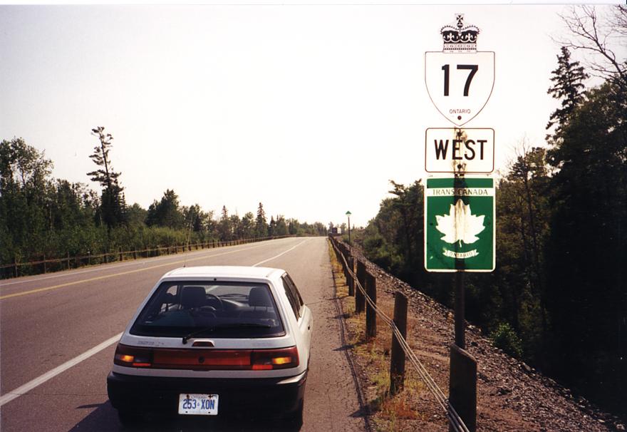
The Trans-Canada Highway through Ontario
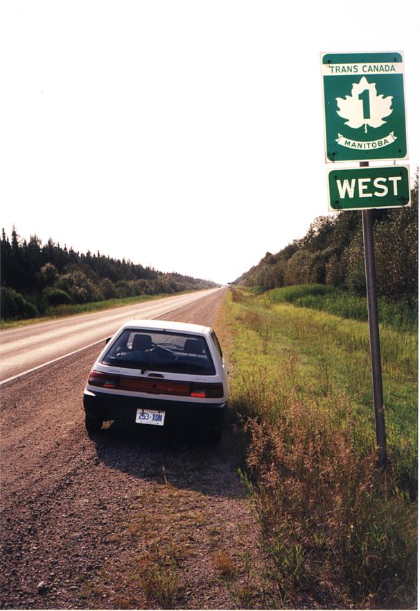
The Trans-Canada Highway through Manitoba
| Friday August 21 |
Portage La Prairie, MB: 206 646 kms
|
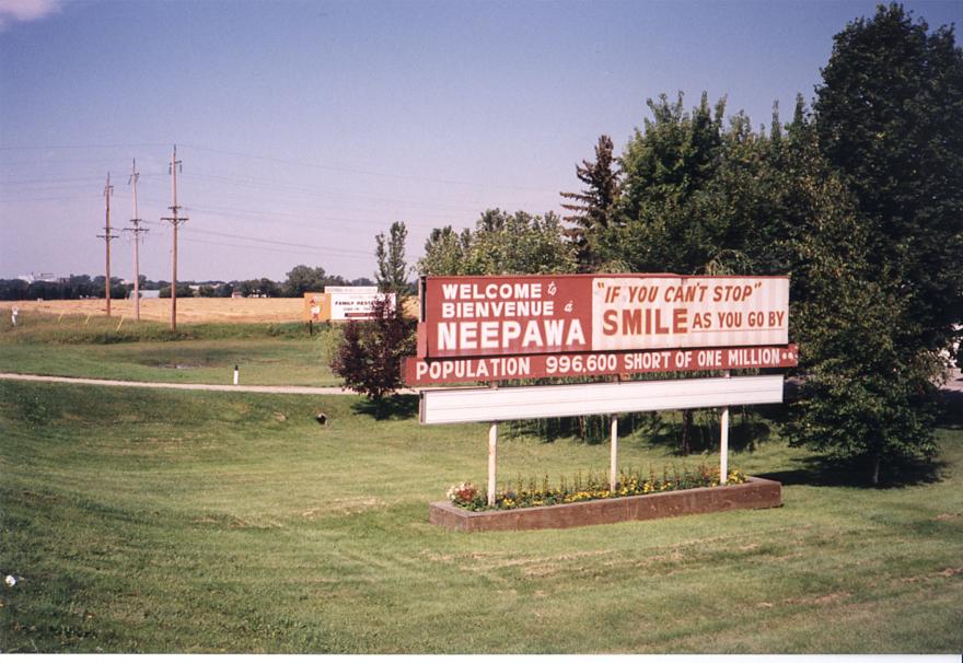
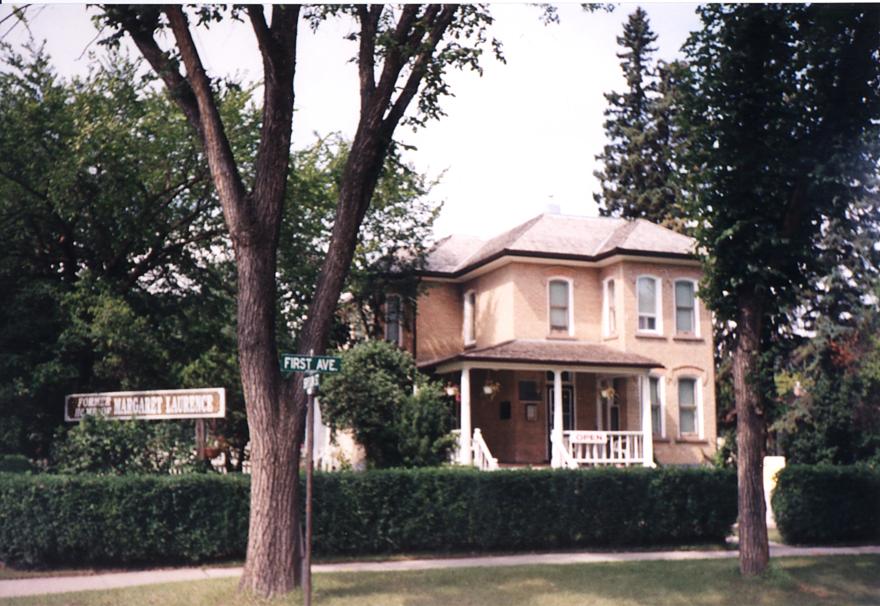
Welcome to Neepawa, Manitoba, home of Margaret Laurence.
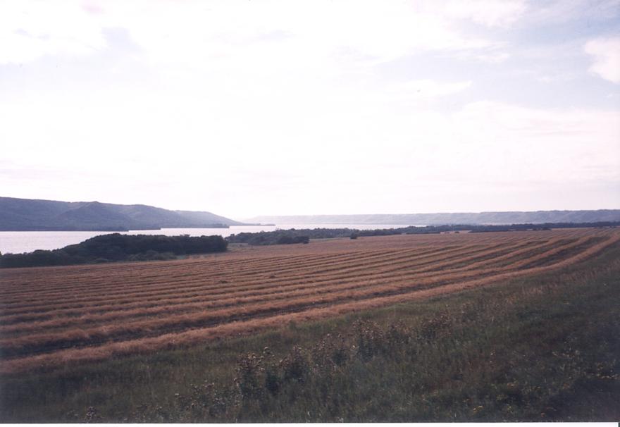
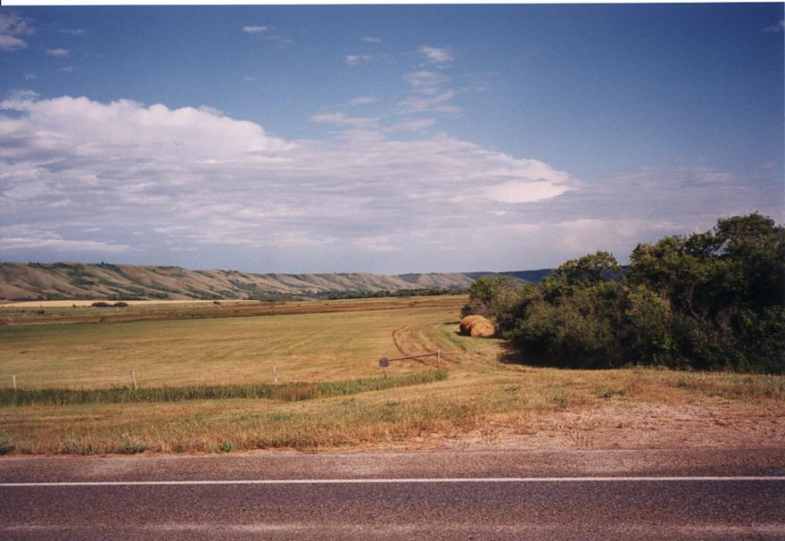
The Qu'Apelle River Valley (I)
The Qu'Apelle River Valley (II)
| Saturday August 22 |
Regina, SK: 207 255 kms
|
| Sunday August 23 |
Medecine Hat, AB: 207 905 kms
|
| Monday, August 24 |
Wasa, BC: 208 492 kms
|
| Tuesday August 25 |
Jasper National Park, AB: 208 905 kms
|
| Wednesday August 26 |
Smithers, BC: 209 717 kms
|
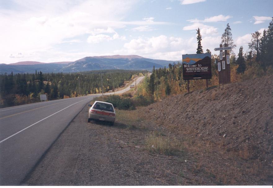
| Thursday August 27 |
Watson Lake, YT: 210 562 kms
|
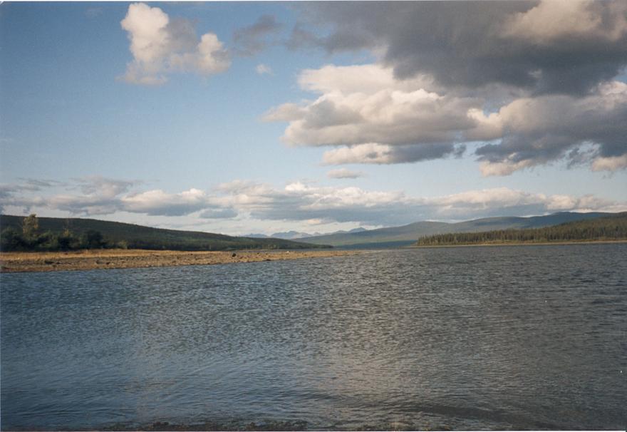
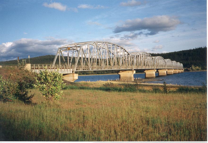
Teslin Lake, home of the longest over-water bridge on the Alaska Highway.
| Friday August 28 |
Teslin, YT: 211 228 kms
|
| Saturday August 29 |
Tetsa River Provincial Park, BC: 211 953 kms
|
| Sunday, August 30 |
Williamson Provincial Park, AB: 212 741 kms
|
| Monday, August 31 |
Stony Plain, AB: 213 140 kms
|
| Tuesday, September 1 |
Ghost Lake, AB: 213 565 kms
|
| Wednesday, September 2 |
Summerland, BC: 214 206 kms
|
| Thursday, September 3 |
Burnaby, BC: 214 660 kms
|
| Saturday, September 5 |
Vancouver, BC: 214 815 kms
|
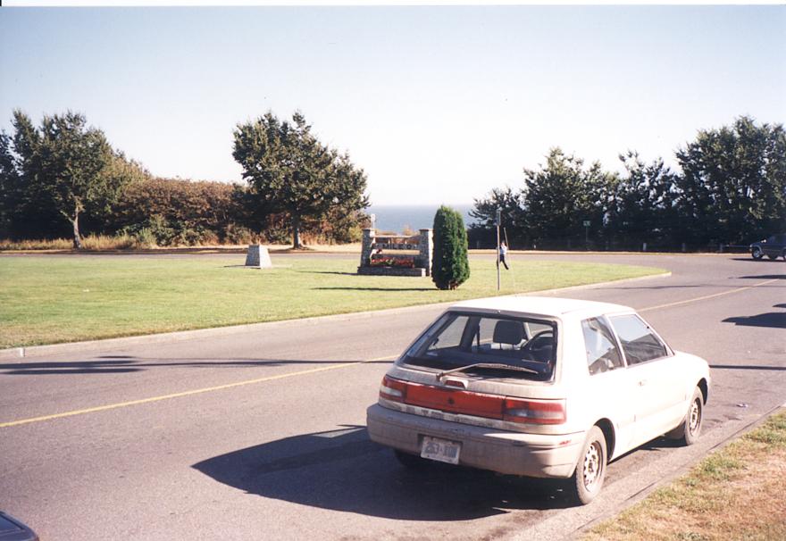
The other TCH "Mile 0" marker (I)
The other TCH "Mile 0" marker (II)
| Sunday, September 6 |
Malahat, BC: 214 986 kms
|
| Tuesday, September 8 |
Bellevue, WA: 215 320 kms
|
| Wednesday, September 9 |
Warrenton, OR: 215 691 kms
|
| Thursday, September 10 |
Langlois, OR: 216 148 kms
|
| Saturday, September 12 |
San Jose, CA: 217 182 kms
|
| Sunday, September 13 |
San Simeon, CA: 217 550 kms
|
| Monday, September 14 |
Encinitas, CA: 218 080 kms
|
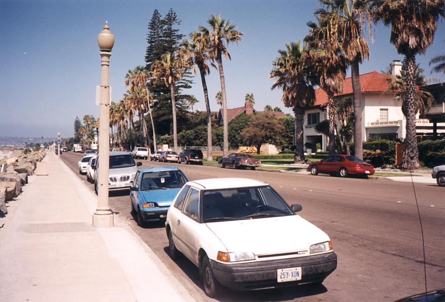
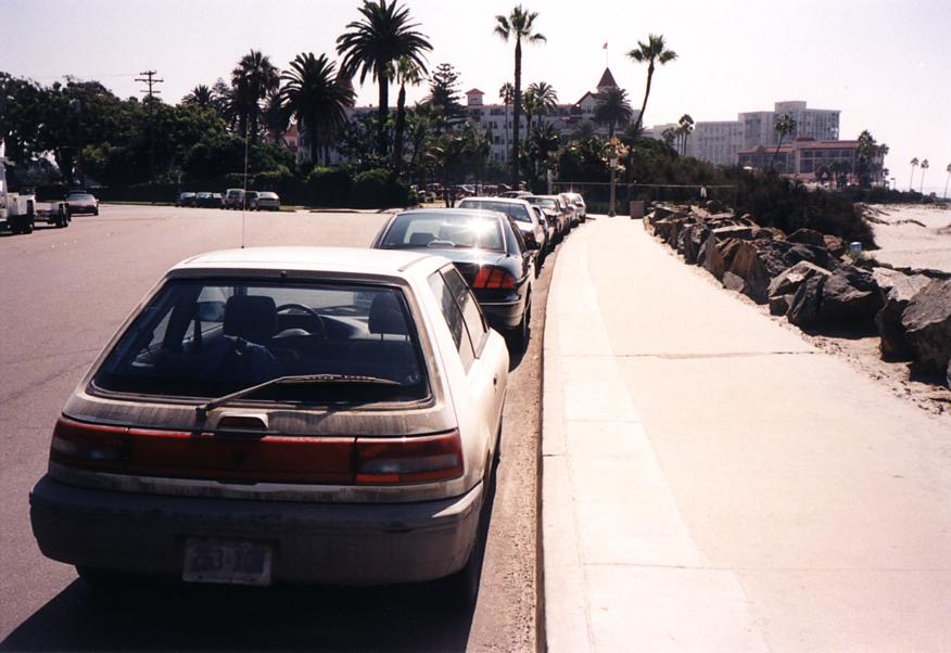
Parked in front of the Hotel Del Coronado, San Diego, CA, USA (I)
Parked in front of the Hotel Del Coronado, San Diego, CA, USA (II)
| Tuesday, September 15 |
Encinitas, CA: 218 645 kms
|
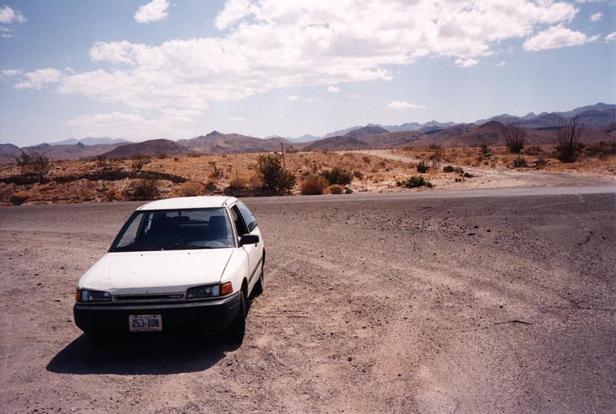
I wish I had air conditioning.
| Wednesday, September 16 |
Tucson, AZ: 219 374 kms
|
| Thursday, September 17 |
Flagstaff, AZ: 219 884 kms
|
| Friday, September 18 |
Albuquerque, NM: 220 495 kms
|
| Saturday, September 19 |
Watonga, OK: 221 362 kms
|
| Sunday, September 20 |
Joplin, MO: 221 845 kms
|
| Monday, September 21 |
Carlyle, IL: 222 415 kms
|
| Tuesday, September 22 |
Bloomington, IN
|
| Wednesday, September 23 |
Franklin, IN: 222 789 kms
|
| Thursday, September 24 |
Windsor, ON 223 648 kms
|
| Friday, September 25 |
Ottawa, ON: 224 483 kms
|